West Coast and Alghero
Between the Catalan ramparts of Alghero, the cliffs of Capo Caccia and the quartz beaches of Sinis, the west coast concentrates 200 kilometres of history and contrasting landscapes.
Sardaigne's west coast stretches for nearly 200 kilometres between the Gulf of Asinara to the north and the Gulf of Oristano to the south. Our team considers it the island's most contrasting shoreline: 300-metre limestone cliffs at Capo Caccia, shallow lagoons of Sinis where flamingos nest, cereal plains of Nurra, and volcanic hills of Planargia around Bosa. It is also the region where history has left its most visible traces, from Bronze Age nuraghes to still-standing Catalan fortifications.
Alghero, which locals call l'Alguer, remains the region's anchor point. Founded in the 14th century by Aragonese who expelled the Genoese, the city has preserved its language: a medieval Catalan still taught in schools and displayed on street signs, alongside Italian. The ochre sandstone ramparts, seven towers still standing, enclose a historic centre about 600 metres long where you wander between the Cathedral of Santa Maria, the Church of San Francesco and red coral workshops. Red coral fishing, practised in the Riviera del Corallo since the Middle Ages, still feeds a local jewellery trade that we visit with our artisan contacts.
Half an hour's drive west, the Capo Caccia headland drops sheer into the sea. Neptune's Cave opens at water level: you descend via the Escala del Cabirol, 654 steps carved into the cliff face, or by boat from Alghero port in 50 minutes. Inside, a 120-metre-long underground salt lake and limestone formations dating back tens of thousands of years. Higher up on the plateau, the pre-nuragic necropolis of Anghelu Ruju groups 38 tombs carved into tuff around 3000 BCE.
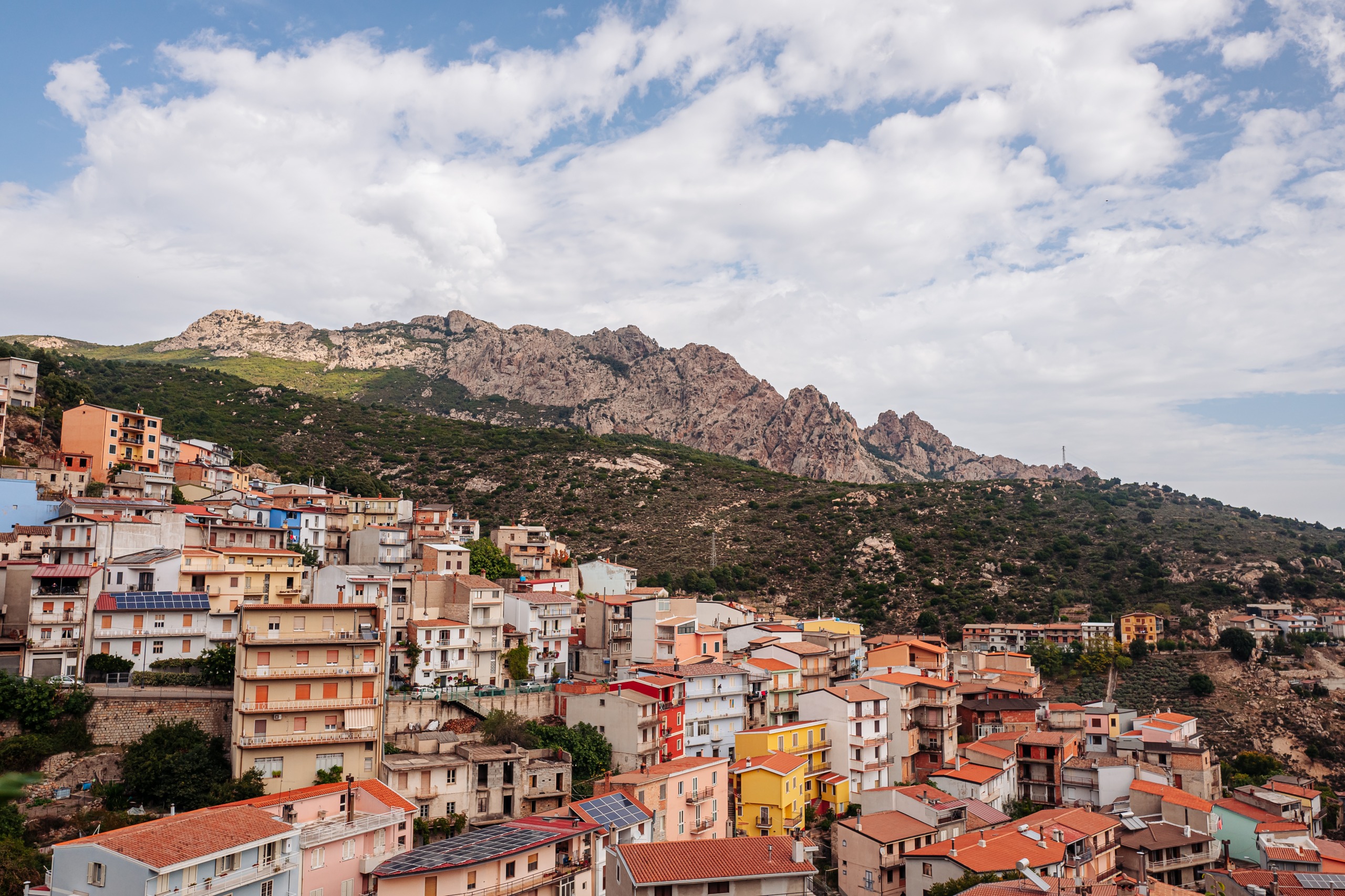
The coastal road leading to Bosa, 45 kilometres to the south, is one of the island's finest: hairpin bends above empty space, scrubland of rockrose and dwarf palms, griffon vultures nesting in the cliffs of the Porto Conte natural park. Bosa itself lines the banks of the Temo, Sardaigne's only navigable river, with its pink, yellow and blue-fronted houses beneath the Malaspina castle. This is where Malvasia di Bosa is made, an amber sweet wine aged under veil that we have you taste at two family winemakers.
Further south still, the Sinis peninsula changes character radically. The landscape flattens, the coast becomes low and sandy. Tharros, founded by the Phoenicians in the 8th century BCE and later occupied by Carthaginians and Romans, sits on a tongue of land facing the island of Mal di Ventre. The columns of the tophet, the thermal baths and the paved street descend to the sea. A few kilometres away, the beaches of Is Arutas, Mari Ermi and Maimoni are composed of white and pink quartz grains 2 to 5 millimetres across, remnants of granite erosion: it is forbidden to take any away, and we stress this point with our travellers.
The hinterland is also worth exploring. The Nurra plain produces Sardaigne's olive oil and spiny artichokes, the PGI that flavours antipasti. In Cabras, on the lagoon of the same name, mullet is caught whose dried eggs make bottarga, grated over pasta with clams. And in early September, the Corsa degli Scalzi sees village men run barefoot for 7 kilometres to carry the statue of Saint Salvatore, a procession inherited from the 16th century that is no folksy re-enactment.
To discover
Alghero ramparts at sunset. 1.5-kilometre walk along the Catalan bastions overlooking the bay, with a stop at the Torre di Sulis. The sandstone stones turn vivid orange around 7pm in summer.
Neptune's Cave by sea. Approximately 50-minute crossing from Alghero port to the foot of Capo Caccia's cliffs, then a 200-metre underground walk around the Lamarmora salt lake.
Quartz beaches of Sinis. Is Arutas, Mari Ermi and Maimoni line their white and pink grains over 8 kilometres of low coast, facing the uninhabited island of Mal di Ventre.
Tharros archaeological site. Phoenician trading post then Roman city on the San Giovanni peninsula. 2-hour visit among columns, thermal baths and a paved street descending to the sea.
Bosa and the Temo valley. Colourful facades along the island's only navigable river, Malvasia tasting with Planargia winemakers, griffon vulture spotting along the coastal road.
When to go
We recommend the west coast from April to mid-June, then from mid-September to end of October. In spring, almond and asphodel trees bloom around Bosa, temperatures hover between 18 and 24°C, and the sea reaches 19°C in late May for early swimming. It is also the season when griffon vultures are visible around their nests. Autumn offers water still at 22°C in October and low light perfect on the cliffs of Capo Caccia.
July and August combine disadvantages: frequent temperatures between 32 and 36°C in the Nurra plain, crowded beaches at Alghero and Sinis, doubled prices, and the mistral wind that can blow for three days straight at 60 km/h. December to February remain mild on the coast, averaging around 13°C, but several establishments close and certain boat services to Neptune's Cave are suspended in case of swell.
Practical advice
Our team recommends a minimum of 4 days for the region, 5 to 6 if you want to combine Alghero, the Bosa coast, Sinis and an archaeological detour. Alghero-Fertilia airport, 10 kilometres north of the city, is the logical entry point with direct flights from several European cities. Distances remain reasonable: Alghero-Bosa in 1h15 by coast, Alghero-Tharros in 1h45 via the SS131.
The region combines naturally with Gallura and the North for a ten-day coastal itinerary, or with Barbagia and Supramonte if you want to alternate sea and mountains over 12 to 14 days, with Supramonte being 2 hours' drive from Sinis. Hotel comfort is good in Alghero, more variable in Sinis where we work with family agriturismos. The region suits travellers curious about history and archaeology, wine and local produce enthusiasts, and families with children old enough to walk: the trails at Capo Caccia or a stroll along Alghero's ramparts remain accessible from age 7 or 8 onwards.